

“The town is flooding!” a worker at the Nicholas County Nursing and Rehabilitation Center in Richwood, West Virginia, yelled to Nancy Mullins around 1 p.m. on June 23, 2016.
Thinking of her children, Mullins, a cook at the nursing home, raced to their home a block from the Cherry River, moved them to safety, and returned to the nursing home. In the short time she was gone, the flood was already in the laps of elderly residents in wheelchairs.
As workers panicked around her, Mullins took charge. “We’ve got to get these people out of here,” she yelled at her boss. A school bus driver brought two buses and began transporting the 95 residents to Liberty Baptist Church.
“It was like slow motion, you got to move, we need teamwork, you hold, you do that. Was happening so fast, no time to react, just had to do. I never saw myself doing this in my whole life,” she said.
Workers carried fragile elderly people, with feeding tubes, IVs, and bandaged limbs, out the narrow gap between the back door and retaining wall. A son of a resident grabbed Mullins and saved her from drowning as a torrent knocked her down. After water rose too high for a bus, Mullins helped carry the last 12 residents on sheets through high water to the church. Patients, some with Alzheimer’s, slept on wooden pews, and unknown numbers later died at facilities far away.
When she finally got home, Mullins found Cherry River overflow had filled her house up to the kitchen counter. A neighbor’s deck was lodged against her back door.
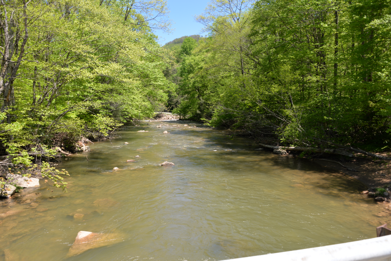
In just a few hours, the storm dumped nearly 9 inches of rain on this tiny city at the edge of the Monongahela National Forest. Gushers roared down the South and North Forks, then smacked into the Cherry River as it rose over its banks like a tsunami. Hillside streets funneled torrents to the city below.
Eighty homes were destroyed, 100 were damaged. The high and middle schools were damaged beyond repair. The only grocery store closed and was demolished. Streets became ravines, water, and sewer pipes twisted and erupted. The nursing home has closed, taking away 136 jobs. Damages cost the federal government alone at least $60 million.

“They Don’t Care If We Wash Away”
Now five years later, the flood disaster is far from over. After nearly losing the schools to consolidation 30 miles away, the city of 2,000 residents will have its middle and high schools built atop the elementary school, nearly a mile from athletic fields in the center of the city.
The state auditor found the state emergency management agency had failed to guide the spending of FEMA funds, and the audit alleged widespread financial mismanagement by city officials and residents paid to oversee the first months of recovery. FEMA has not fully reimbursed flood costs. The city is nearly bankrupt.
All this could have been prevented.
But the way the Flood Control Act of 1936 has been interpreted over the years effectively makes Richwood too poor for the federal government to protect from flooding.
Three times in five decades, the U.S. Department of Agriculture (USDA) Soil Conservation Service (SCS) and the U.S. Army Corps of Engineers compared the cost of building flood protection structures to the benefits they created, and each time ruled the cost of flood control was greater than the value of the buildings protected. Such an approach to cost-benefit analysis (CBA) does not consider the danger to people or socioeconomics of a community.
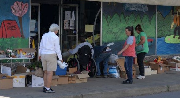
When FEMA officials held an informational meeting shortly after the flood, Bonnie Bailey Kroll, who had volunteered to run a distribution center in a vacant Main Street store, asked, why her community didn’t get flood gates or floodwalls. “I was told we didn’t have enough revenue [for it] to be feasible,” she said.
“In other words, they don’t care if we wash away” said her assistant Linda Jarvis, whose nursing home job had been destroyed by the flood.
Richwood is just one of numerous such places considered not worth protecting. After a historic 2008 flood in Cedar Rapids, Iowa, the Corps of Engineers would only fund flood protections for the east side of the Cedar River with a Quaker Oats Plant and other facilities. The west side, with lower-income and elderly residents, wasn’t worth as much.
“There is a bias in the CBA against low-value properties and communities where the flood risk is mostly for low-value properties, said Leonard Shabman, a senior fellow at Resources for the Future, in an email interview.“This bias is well understood and has long been recognized.”
During testimony on the revision of guidelines for water resource implementation studies in 2008, Gerald E. Galloway, Glenn L. Martin Institute Professor of Engineering at the University of Maryland stated that “Many projects with strong environmental, social, and public safety benefits have been left on the table to the detriment of efforts to protect our natural environment, provide social justice for those who need our support, and offer life safety to the many people who live at risk in areas where the economic benefits alone do not justify their protection.”
According to the 2004 Statewide Flood Protection Plan, “generating economic benefits in small communities in West Virginia can be a daunting task.” The plan also admitted that “in West Virginia, as in many parts of Appalachia, there are only a handful of municipalities that contain the population density and development values that can generate sufficient flood damage benefits to justify construction of major flood protection benefits. Therefore, under current flood-protection justification methods and regulations, these communities must continue to endure repeated flood damages and loss of life.”
Neither the Corps of Engineers nor USDA could provide data on the number of projects denied for failing a CBA. However, residents and officials of flood-prone communities can ask the local USDA and Corps of Engineers offices if studies were done. Richwood’s USDA file of 165 documents reveals how denials happen.
A Rich Community That Exceeds Expectations
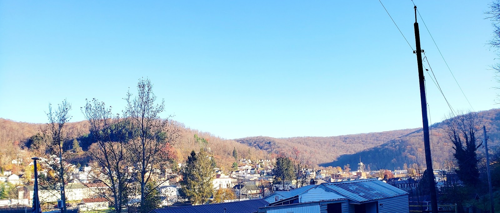
Settled in the late 1800s by trappers and fishermen and grown on lumber, paper, coal and a tannery, Richwood is a tight-knit community that aims to exceed expectations. It was the largest city, population 7,000, within 100 miles in 1927, and it boasted the world’s largest clothes pin factory and the largest sole leather tannery. Main Street is now listed in the National Register of Historic Places. Richwood native Mike Barrett played on the 1968 amateur Olympic basketball team that shocked the world during the Cold War by upsetting the heavily favored Russians for the Gold Medal.

While the decline in coal mining and a four-lane highway 30 miles away shrank the city in the 1980s, before the 2016 flood Richwood had all the components of a solid town: city hall, library, post office, shopping plaza, convenience stores, auto repair shops, two lumberyards, funeral home, a local dentist and doctor, restaurants, and gas stations. A U.S News & World Report 2014 Bronze Award plaque adorned the high school.
The city also exceeds the mark when it comes to flooding, with floods documented in 1873, 1918, 1926, 1932, 1940, 1954, 1967, 1979, 1985, 2003, and 2016. In 1967, Richwood leaders asked the USDA SCS to study building a dam.

The Silent Sentinels That Quietly Protect Communities
Prompted by water shortages during the Dust Bowl, and floods rushing over bare land, SCS began building upstream dams in 1948. “Watershed dams are silent sentinels because they quietly protect communities,” wrote retired USDA engineer Larry Caldwell, author of the 2020 USDA Watershed Programs Facts and Figures – A Reservoir of Watershed Program Information.
“After a heavy rain event, they spring into action. They capture rushing flood water and hold the water back allowing it to be slowly released downstream. Slowing the water down and allowing it to be gradually released reduces damage to downstream roads, bridges, fences, cropland, and other property.”
SCS and its successor, the Natural Resources Conservation Service (NRCS), built 11,841 of the nation’s 91,457 dams.
After peaking in the mid 1960s, SCS ended most construction by 1990. The 2,196 high-hazard USDA dams that protect human life and property are being inspected and repaired if necessary. None will be removed. “While the dams have been so important in the past 60 or 70 years, they’re going to be even more so for the next generation,” Caldwell wrote in his USDA Facts and Figures report. “I don’t know all the science behind all the projections on climate change, but it sure seems like when you look at the last decade, we’ve experienced much more extreme weather conditions. That goes for both prolonged droughts as well as devastating floods.”
However, approaches to flood control now favor removing levees and dams and letting flood waters spread out. But in many, often poorer parts of Appalachia, small towns are tucked between steep mountains, leaving no place for water to spread out. Indeed, the mountains, often timbered, mined or laced with gas well roads, send extra water to the rivers. So the original SCS method of holding waters upstream until storms end has worked well there.
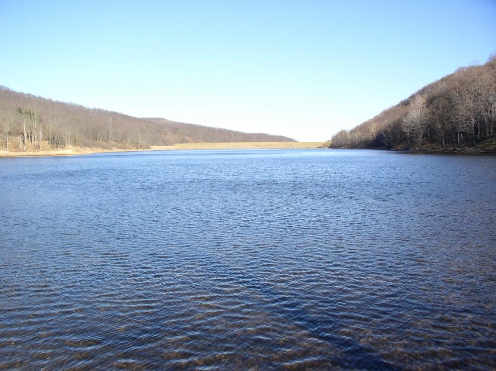
In Richwood, SCS did study how to lessen flooding and increase the supply of municipal water. In 1967, it concluded 340 homes and 60 commercial properties could flood. Introducing a 70-acre lake several miles up the South Fork of the Cherry River, combined with three smaller flood retarding structures on three nearby streams, would reduce damages of the largest flood by 95 percent, and provide recreation, water, economic growth and employment. SCS was authorized to pay $3.8 million of the total $4.8 million cost (the equivalent of $37 million today).
Caldwell stressed that determining cost-benefit can be complex, and agency staff did try hard to find every benefit. Half a dozen mixes of benefits were developed for Richwood. Only with potential development did the dam pass. But the shared cost of $956,400 was too much for Richwood, and the project was dropped. Besides, the study stated, a 1958 Corps river channelization would lessen flooding,
Repeated Attempts, Destined for Failure
In 1987, two floods later, local leaders asked SCS for another study. This time, flood-weary residents gathered 18 pages of petitions with nearly 900 signatures and lobbied state and federal legislators. Mayor Robert Johnson stressed the need for additional water supply for industrial development, more houses, and a large home for elderly residents. By then SCS had built 167 of the 170 flood control dams that now exist in the state. Richwood folks wanted the 168th.
The dam appeared destined for failure from the start, SCS officials told Richwood’s U.S. senators and house member: “According to current regulations we could not count many of the benefits today that are displayed in the [1967] report. Also, more stringent design criteria has caused prices to increase dramatically. Therefore, it is highly unlikely that a project could be justified under any of our flood prevention programs today.”
The dam failed on benefit-cost criteria, 0.49 to 1.0. SCS concluded, “the remaining flood problem in Richwood, although serious during major floods, is insufficient to justify significant project action.”
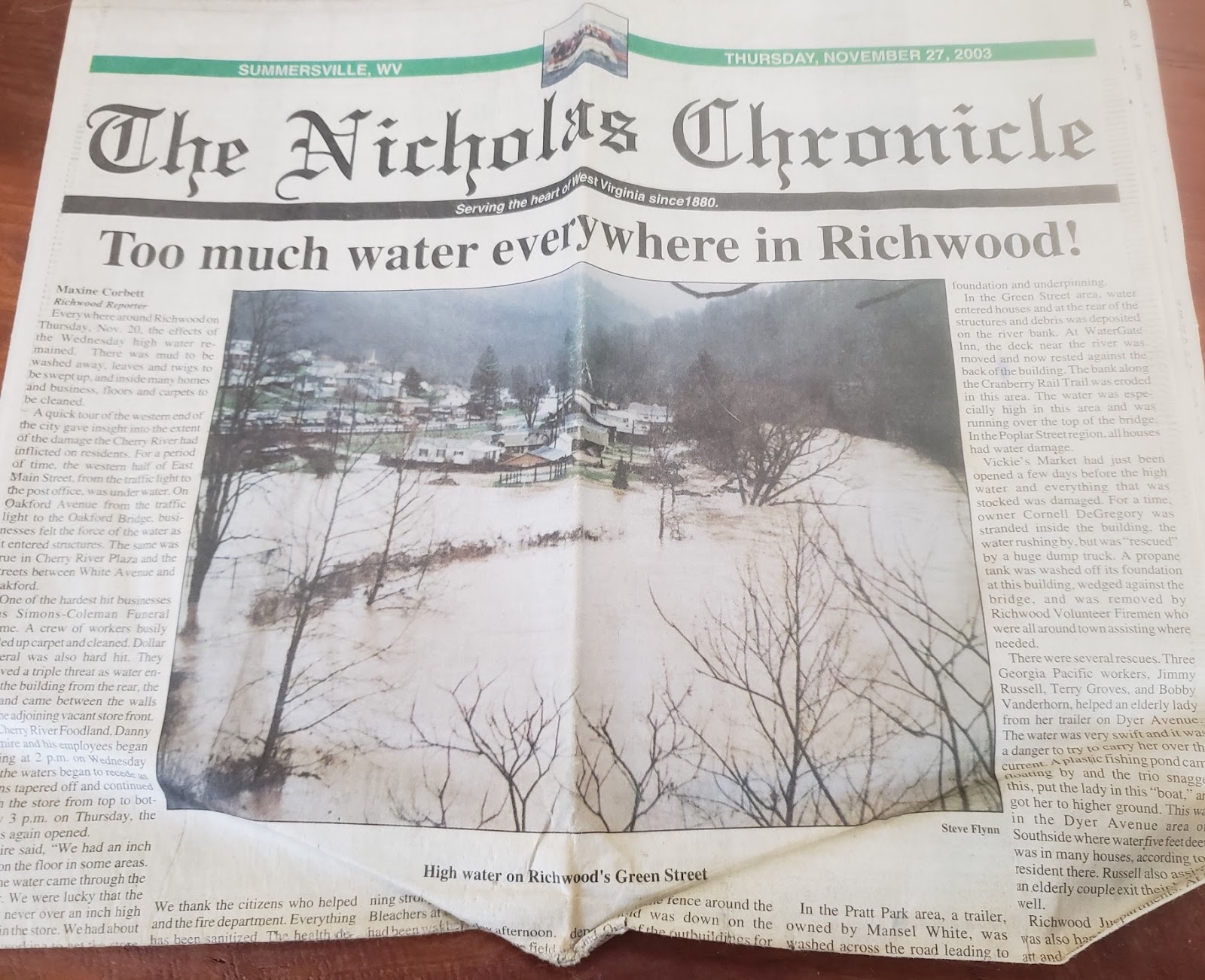
Then came back-to-back floods in November 2003, damaging 370 residences and 25 businesses, and dumping raw sewage from broken pipes into the river for three years. This time SCS was already overwhelmed with project requests after floods in 2001 and 2002 swept through the southern part of the state, killing 10 people and impacting at least 20,000 residents.
Led by retired Army Colonel Ralph Kelly and John Dietz, residents and city officials turned next to the Corps of Engineers. The Corps has constructed 24 flood risk management dams and 19 protective levees and floodwall systems in the state. During the 2016 floods, Corps dams helped prevent severe flooding in Charleston. Larger than SCS dams, Corps dams often created spacious recreation areas.
A binder of records, six inches thick, describes Richwood’s four-year effort: more than 3,600 people signed petitions, and more than 40 organizations endorsed the project. Every local, state, and congressional representative wrote support letters. Senator Robert Byrd and Representative Nick Rahall obtained funds for the study. This time, supporters stressed the hydropower potential of the dam, as well as flood protection.
The Corps determined a South Fork dam and recreation lake would cost $347 million. Noting that 725 residential structures in the Cherry River basin could be damaged in a 100-year-flood, the Corps outlined nine alternative measures to pick and choose from: ringwall along the Cherry River, $31 million; ringwall downstream of the city, $28 million; small levee for elementary school, $105,000; ringwall for the nursing home, $2 million; hospital veneer wall, $1.1 million; ringwall for National Guard Armory, $3.1 million; ringwall for high and middle school and shopping plaza, $10 million; library veneer wall, $609,000; municipal building veneer wall, $742,000.
All failed cost-benefit analysis. Only a flood warning system was calculated as more beneficial than the cost. But it was never installed. The final 2008 study acknowledged “serious flood risk managements exist in the Cherry River basin, especially for the city of Richwood, with potential average annual flood damages of $1.7 million.”
Despite that defeat, in early 2009, the South Fork Lake committee kept trying. In March 2009, the group asked then Governor Joe Manchin for $25 million of the Obama administration’s stimulus funds helping states recover from the Great Recession. But Manchin had submitted the state request three months earlier.
Upon resigning from the committee in December 2008, leader Ralph Kelly, who had been a budget liaison officer at the Pentagon, left a doable plan: The timber company could obtain a permit to build the hydro electric lake, or sell to private investors with the guarantee of a Corps permit. By having private funds involved, it would be easier to persuade the West Virginia congressional delegation to support funding for a private economic enterprise to restore the City of Richwood.
After the 2016 flood, the Corps was supposed to study the flooding again. Senator Joe Manchin secured a provision in the Water Resources Development Act (WRDA) 2016, authorizing the Army Corps of Engineers to study the hydrology of the Kanawha River Basin, including the Elk River Basin, the Greenbrier River Basin and the Cherry River Basin to reduce flood risks, enhance the ecosystem, support navigation, water supply, recreation and other water resource related purposes. The study was never funded, a Corps spokesperson said.
“Of course building South Fork Lake will be expensive, but what will the cost of not building the lake be?” wrote Bob Henry Baber, a Ph.D. college professor who was the Mayor during the study, and for a year after the 2016 flood.
The Contested Definitions of Cost-Benefit
Cost-benefit analysis was born out of one sentence in the declaration of policy of the Flood Control Act of 1936, the first law coordinating flood control measures across the nation: “The Federal Government should improve or participate in the improvement of navigable waters or their tributaries, including watersheds thereof, for flood-control purposes if the benefits to whomsoever they may accrue are in the excess of the estimated costs, and if the lives and social security of people are otherwise adversely affected.” The 1954 Act establishing the USDA watershed program also required “a determination as to whether benefits exceed costs.”
While it had a minimal effect on preventing large expenditures for levees and other flood control during the first decades of the 20th Century, the cost-benefit language immediately posed “the old problems of defining social criteria by which benefits and costs may be evaluated, and of discussing future benefits,” wrote Gilbert F. White in “The Limit of Economic Justification for Flood Protection [1936].” White, then 24, would become known as the Father of Floodplain Management.
For several decades, Galloway, the University of Maryland professor, has told Congress and federal officials that cost-benefit should include “distributive justice, social connectedness, equality, and health and safety considerations.”
Federal flood control law continually evolves, but the most radical change, Galloway said in a phone interview, came when the Reagan administration essentially made national economic development the sole objective, eliminating consideration of environmental benefits, public safety and other social impacts.
“It is a terrible situation in my view,” he said “But there is hope on the horizon.”
That comes in Section 110 of the Water Resources Development Act of 2020 which requires that future analysis by the Corps “fully identifies and analyzes national economic development benefits, regional economic development benefits, environmental quality benefits, and other societal effects.”
While this section is the first time the Corps is mandated to consider the broader benefits, consideration of altering cost-benefit began when the 2007 Water Resources Development Act directed the Principles, Guidelines and Requirements for Federal Investment in Water Resources be updated “to address advancements in economic and analytic techniques; public safety; low-income communities; nonstructural solutions; and integrated, adaptive, and watershed approaches.”
That update took six years and resulted in the Obama administration recommending the new approach government wide. However, Congress, through legislative language, prevented the Corps from implementing the new policies. Now Galloway is keeping a close eye on Section 110 guidelines. “How [section 110] will be implemented will be an interesting question,” he said in an email.
“This could be a game-changer for the Corps,” said Jonathan Aya-ay, Chief of the Planning Branch at the Corps’ Huntington, West Virginia District on February 22. A team at Corps headquarters has been drawing up guidelines, and is now figuring out how to incorporate the equity standards of the Biden administration, he said.
Senator Manchin did not respond to requests for comment.
The Best Chance Yet, As Trauma Rushes Back
All the while, 47 percent of Richwood’s buildings — about 981 — could flood, according to a cutting-edge 2020 study from the First Street Foundation. One-third of Richwood’s 2,127 residents are below poverty level; median household income is $28,641, the Census reported in 2019.
In 2017, Congress granted NRCS funding for 48 projects in 20 states. Richwood is one of six in West Virginia. But while four places have projects for flooding solutions, Richwood’s only project concerns stream habitat and watershed restoration.
When Baber was elected Mayor two days before the 2016 flood his number one goal was building South Fork Lake. Instead, all he could do was help the city survive. But now, he believes, is the best chance for building South Fork Dam and Lake.
With land donated by Weyerhauser timber company, construction help from the coal mine above Richwood, state funding and a variety of nonprofits, the lake could cost as little as $20 million, Baber said. The lake, and possible whitewater rafting could support Richwood’s current focus on tourism.
Richwood is also eligible for a share of $106 million in hazard mitigation funding from the 2016 flood, awarded last year by the U.S. Department of Housing and Urban Development (HUD). Eighty-one percent will be spent on infrastructure. Since HUD complied with the previous Obama administration directive, its cost-benefit analysis must consider economic, environmental, social and resilience factors.
Only about a dozen dams have been built in West Virginia since 2000. But two are relevant to Richwood. Dawson Lake, in adjacent Greenbrier County, attracted a vacation home development. Elkwater Fork, a NRCS dam providing essential drinking water for towns in the Upper Tygart Valley, cost approximately $42 million using more economical roller-compacted cement.
“Richwood is known as the town that wouldn’t die,” Baber said. “The creation of the dam would not only ensure its survival but would guarantee it would thrive. With hydropower as one of the dam’s components, the project would fit perfectly into the matrix of infrastructure development, the Green New Deal, and economic equity for underserved communities.”
The Richwood community still wants the dam, current Mayor Gary Johnson, a former circuit judge, said in an email. “Absolutely. With the floodway and floodplain restrictions it is impossible to find land that is not under some restriction for housing or development. We have a 100-bed nursing home that is not being used at this time.”
“The best ace in the hole the city and “South Fork Lake” project have is Senator Joe Manchin with his Chairmanship [of the Senate Committee on Energy and Natural Resources],” Ralph Kelly, the retired Army Colonel and former South Fork Lake committee leader, wrote in a March 28 email. “And a Governor that knows how to make things happen in the business world! Wealthy people like to find new “pet projects” and this one needs a “benefactor,” Kelly added. “Governor Justice may be just the guy or one of his billionaire friends. But they will need to move quickly to obtain private investors like Weyerhauser and Marriott to get the key private support they need.”
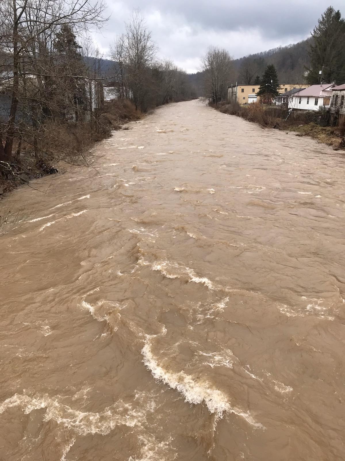
In February, a flood threatened Richwood once again. Between February 26 and the morning of March 1, 2021, three and a half inches of rain poured down and melted heavy snow on surrounding mountains. The Cherry River rose seven feet in a day and a half. Near midnight on February 28, it peaked at 10.59 feet — less than two feet below the record 12.3 feet — damaging the parking lot for the planned K-12 school.
Once more, Nancy Mullins, the nursing home cook, moved her belongings and a zoo of animals to safety. “All the trauma from the last flood comes rushing back and my girls are once again panicked,” she wrote on Facebook.
![]()
